LiDAR Scan
- By
The world is not drawn: you see only the points your lidar measured, with range, reflectance, noise and multiple returns following the lidar equation.
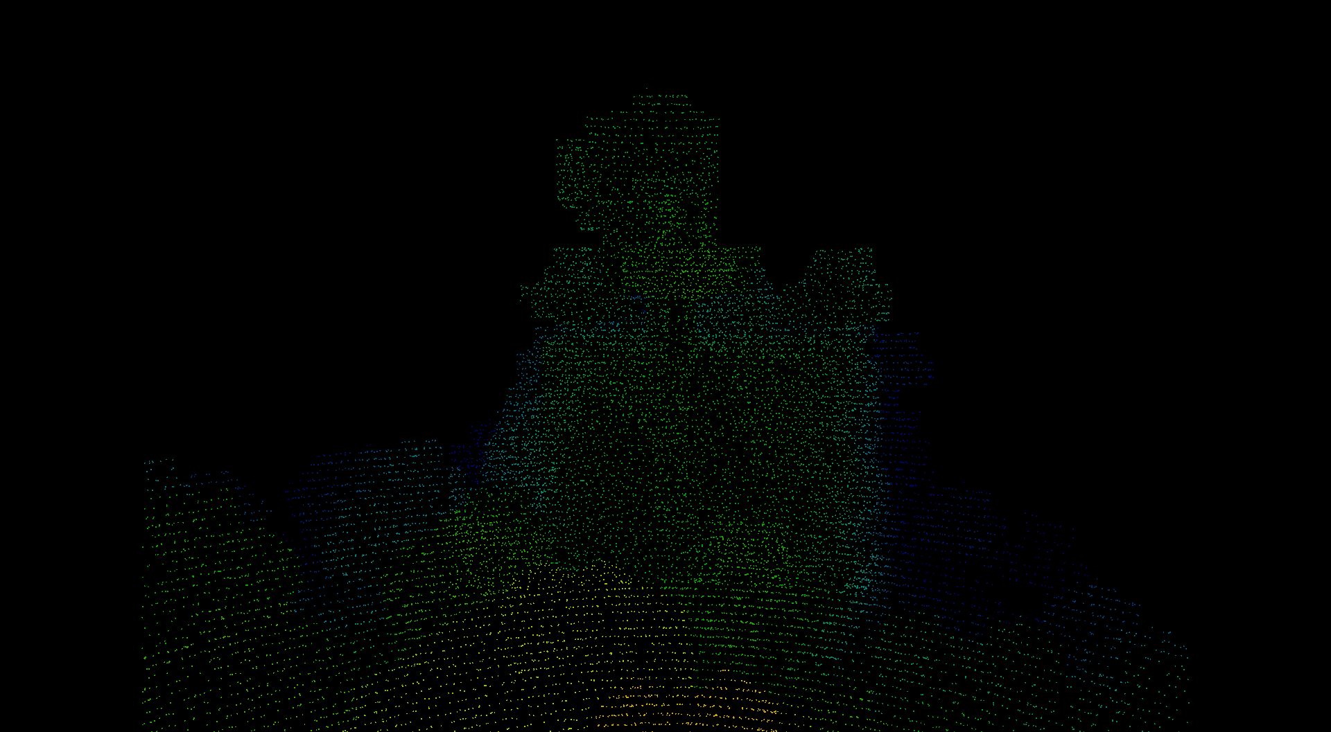
What the mod shows: only the points the sensor measured, on black
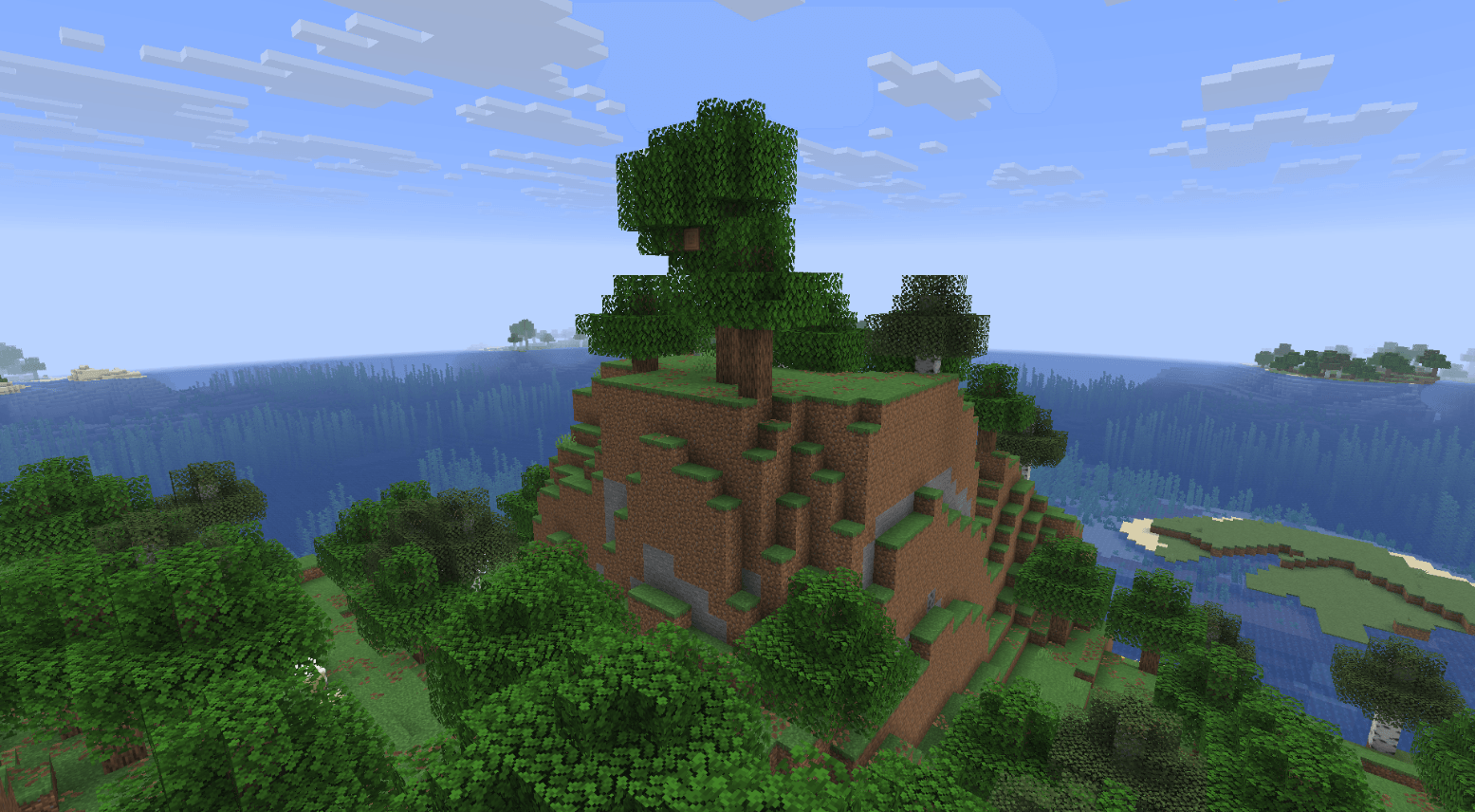
The same spot with normal rendering, for comparison.
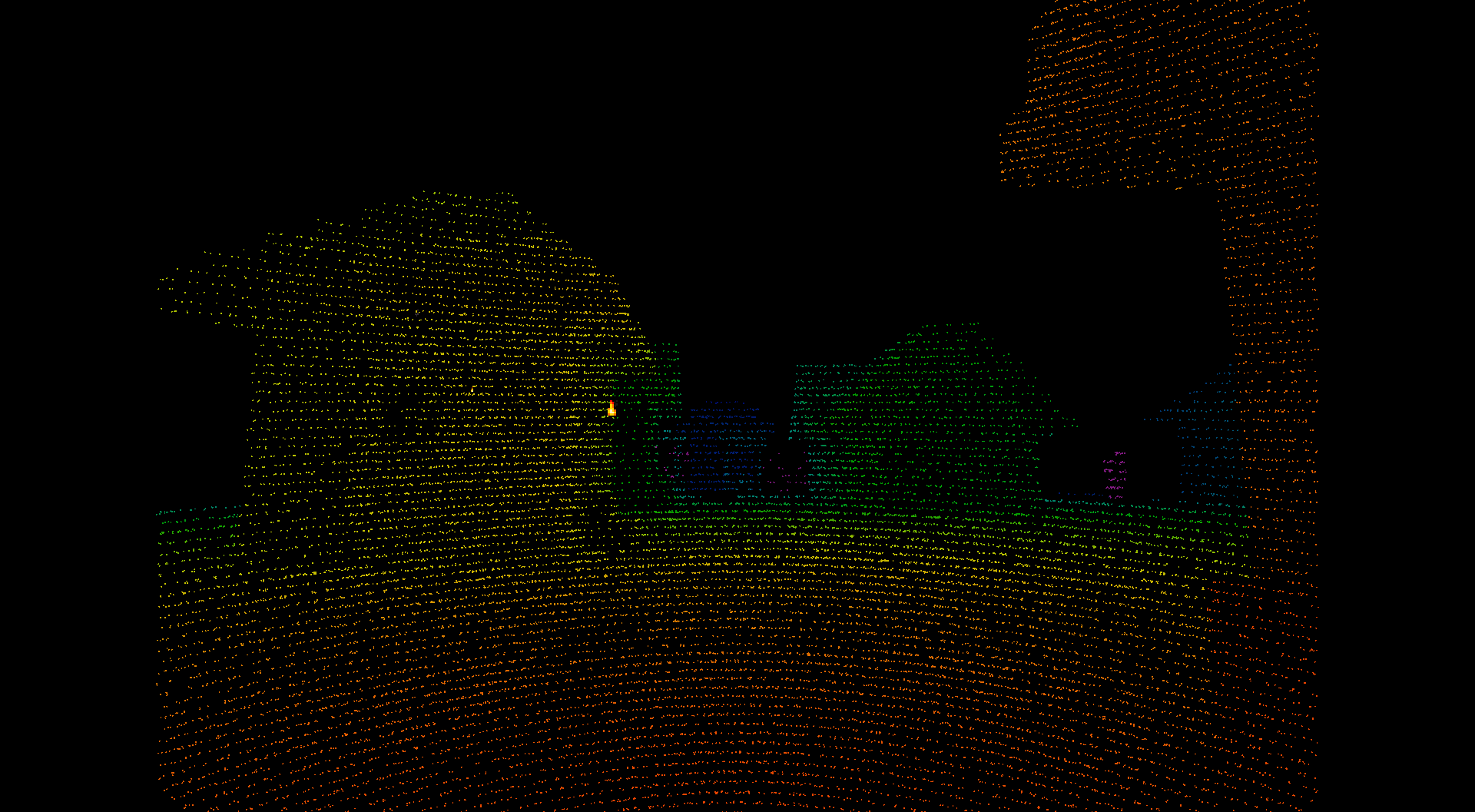
Scan lines and the distance colour ramp are visible.
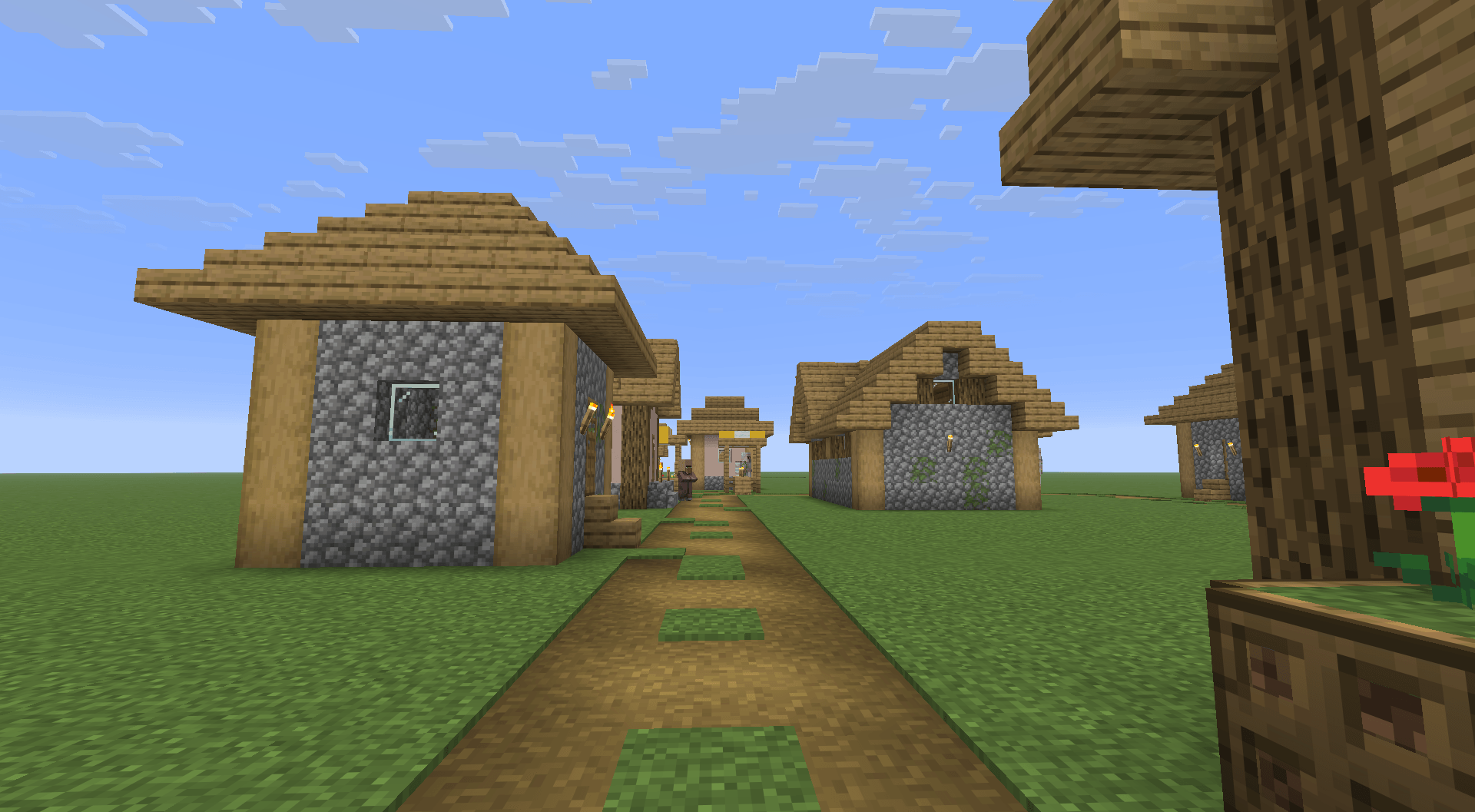
Before scanning, with the world drawn.
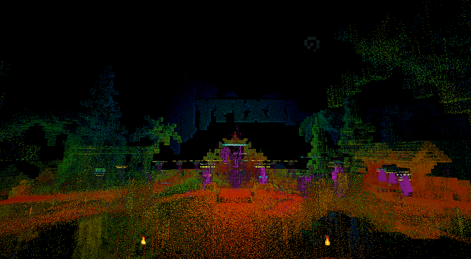
The mod is client side. Nothing is installed on the server, and it reads no block data the client does not already receive.
Description
LiDAR Scan
A lidar scanner for Minecraft 26.2 (Forge). Client side only.
Hold the scan key and the sensor fires a budget of pulses each tick. Every return becomes a point in a cloud that stays where it was measured. The world itself is not drawn, so what you see is the scan and nothing else.
Before you install
The mod does not flash on its own, but two things are worth knowing. The world toggle switches the whole screen between lit and black as fast as you press it, and the point grid is a regular high contrast pattern. Both are recorded triggers for people with photosensitive epilepsy. A sparse cloud on black also asks a lot of contrast vision, and long sessions in the dark tire the eyes.
The mod says the same thing on first launch, on a page you cannot skip.
Requirements
- Minecraft 26.2
- Forge 65 or newer
- Client side only. Nothing is installed on the server, and the mod reads no block data the client does not already receive through normal chunk loading.
Keys
| Key | What it does |
|---|---|
V hold |
scan |
Z |
cycle scan mode: line, cone narrow, cone normal, cone wide, spin |
H |
area map scan of the space around you |
J |
open the settings |
K |
export the cloud of this dimension |
N |
erase the cloud, press twice to confirm |
B |
show or hide the world |
None of them collide with the vanilla bindings.
What the scanner does
Range, reflectance and noise follow the lidar equation rather than a colour ramp on a raycast. The sensor is specified the way real units are: by the range at which a ten percent reflective target still returns.
- Materials carry near-infrared reflectance, specular lobes and transmittance, so glass, leaves and water behave differently from stone.
- A pulse crossing leaves, glass or a fence gate can come back several times. Return mode selects what the receiver reports: all, first, last, strongest or dual, as configured on a real unit.
- Beam divergence, range noise, rain extinction and a daylight noise floor are modelled.
- Geometry comes from models, not collision boxes: a fence gate has a gap between its wings and a flower is two crossed planes.
- Presets load the published specification of a real sensor: Ouster OS0, OS1, OS2.
The cloud holds ten million points by default, thins itself so rescanning a wall costs nothing, expires points when the world changes, and is saved per world - by the world folder, so two worlds of the same name keep their own clouds.
Erasing with N takes both the cloud in memory and the saved one, because a world has one cloud and the mod should not report an empty cloud while holding a full file. Since that loses measurements, the first press only asks and names what would go; the erased file is renamed rather than deleted, and the mod tells you its name.
Export
K writes the cloud of the current dimension to ASPRS LAS 1.4 (point record format 7) or to PLY, or to both. Every point carries colour, return strength as intensity, an ASPRS class code and a scan angle, so the file opens in CloudCompare, QGIS or any survey tool with the fields such a tool expects.
Files land in <game dir>/lidar/export/.
Settings
46 options, each with its unit, its range and the source of its number. Open them with J in game, or from the mods list. Worth knowing first: maxRange, raysPerTick, scanFovDeg, maxStoredPoints, pointSpacing, returnMode, edlStrength, renderRange, exportFormat.
If the frame rate drops, lower raysPerTick first, then maxStoredPoints, then renderRange.
Every option is documented with its unit, range and source on the reference page: https://zenoyui.github.io/lidar-scan/
Compatibility
World hiding is implemented with Mixin against Minecraft render methods, so conflicts are likely with mods that rewrite the same path: Sodium-style optimizers and Iris/Oculus shaderpacks. Not tested against them.
Reporting a problem
Open an issue at https://github.com/Zenoyui/lidar-scan/issues and say which version of the mod you run, what you did, and what happened.
LiDAR Scan Team