
TrueEarth
- By
Explore the real Earth in Minecraft at real scale: real streets, buildings, terrain and landmarks, with live trains, planes and traffic.
01_tour_eiffel.jpg
02_arc_de_triomphe.jpg
03_paris_haussmann.jpg
04_notre_dame.jpg
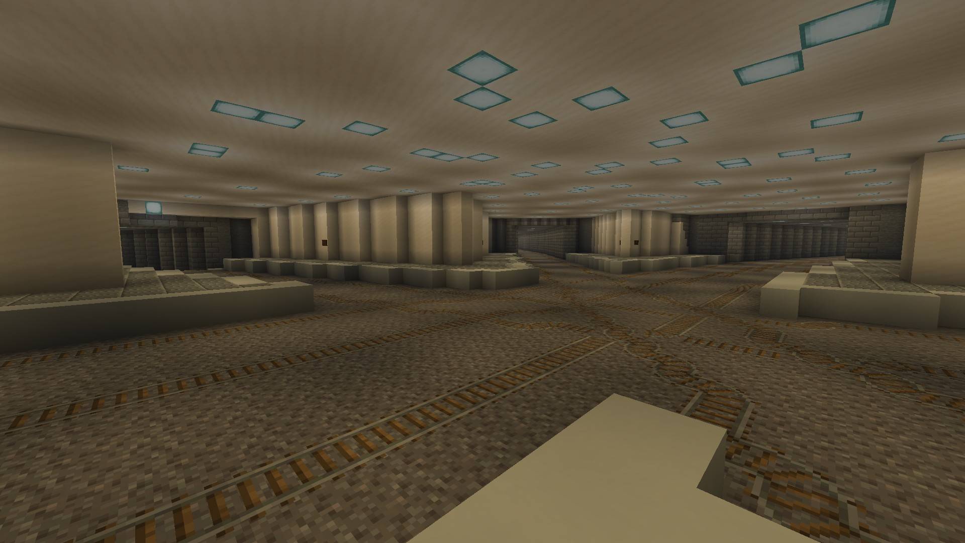
05_metro.jpg
Description
TrueEarth — the real world in Minecraft
Play anywhere on Earth, at real scale. TrueEarth generates the world around you from real geographic data — streets, buildings, terrain, rivers, forests, fields — and brings it to life with real-time traffic, trains and planes.
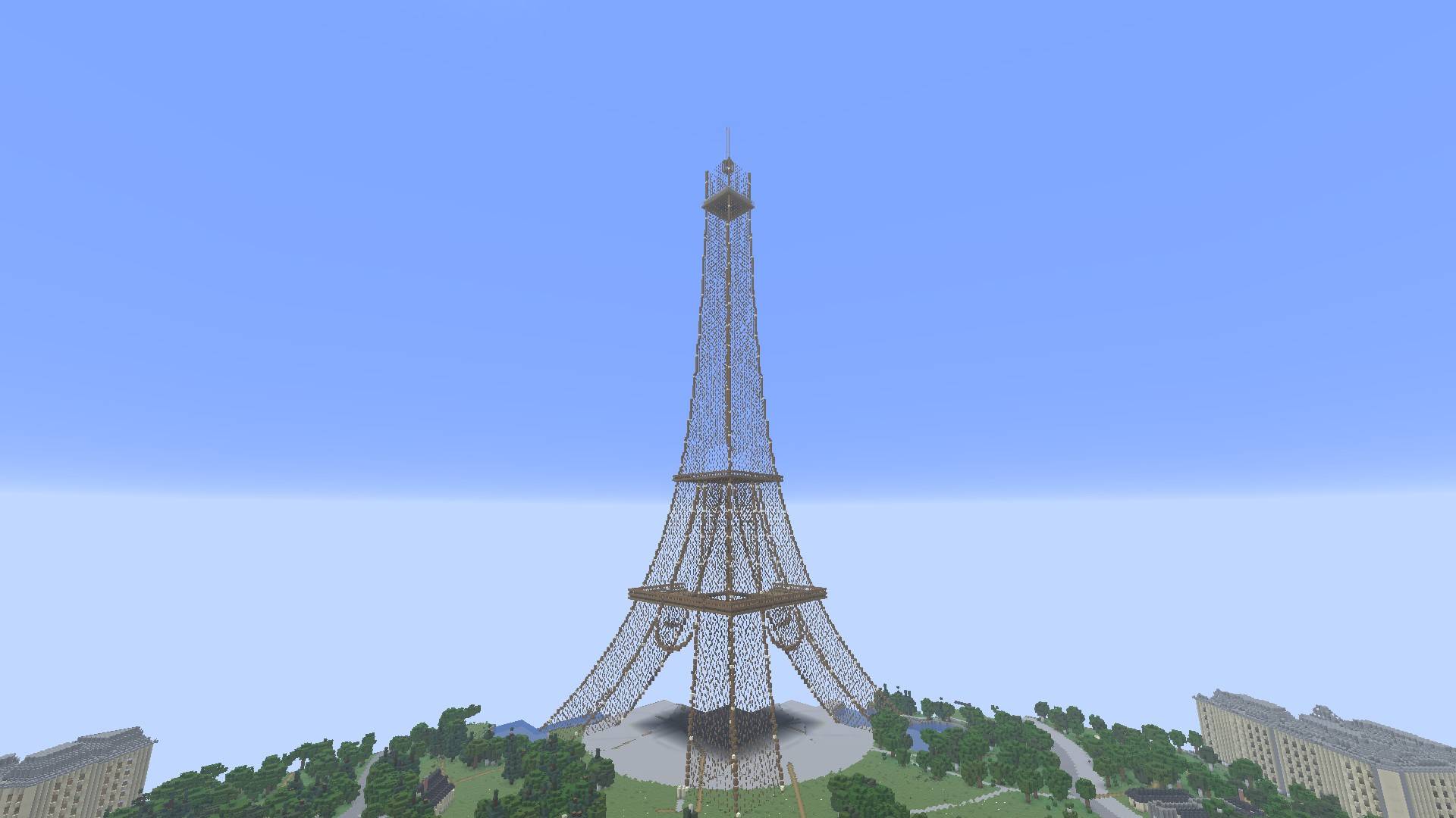
Eiffel tower - Paris
The world as it is
- The whole Earth at 1:1 scale: create a "Whole Earth" world and start from any address. Regions are generated on the fly as you travel.
- Real buildings: real footprints and heights (OpenStreetMap, plus IGN's BD TOPO in France), floor counts, roof shapes and roof colours read from aerial photography.
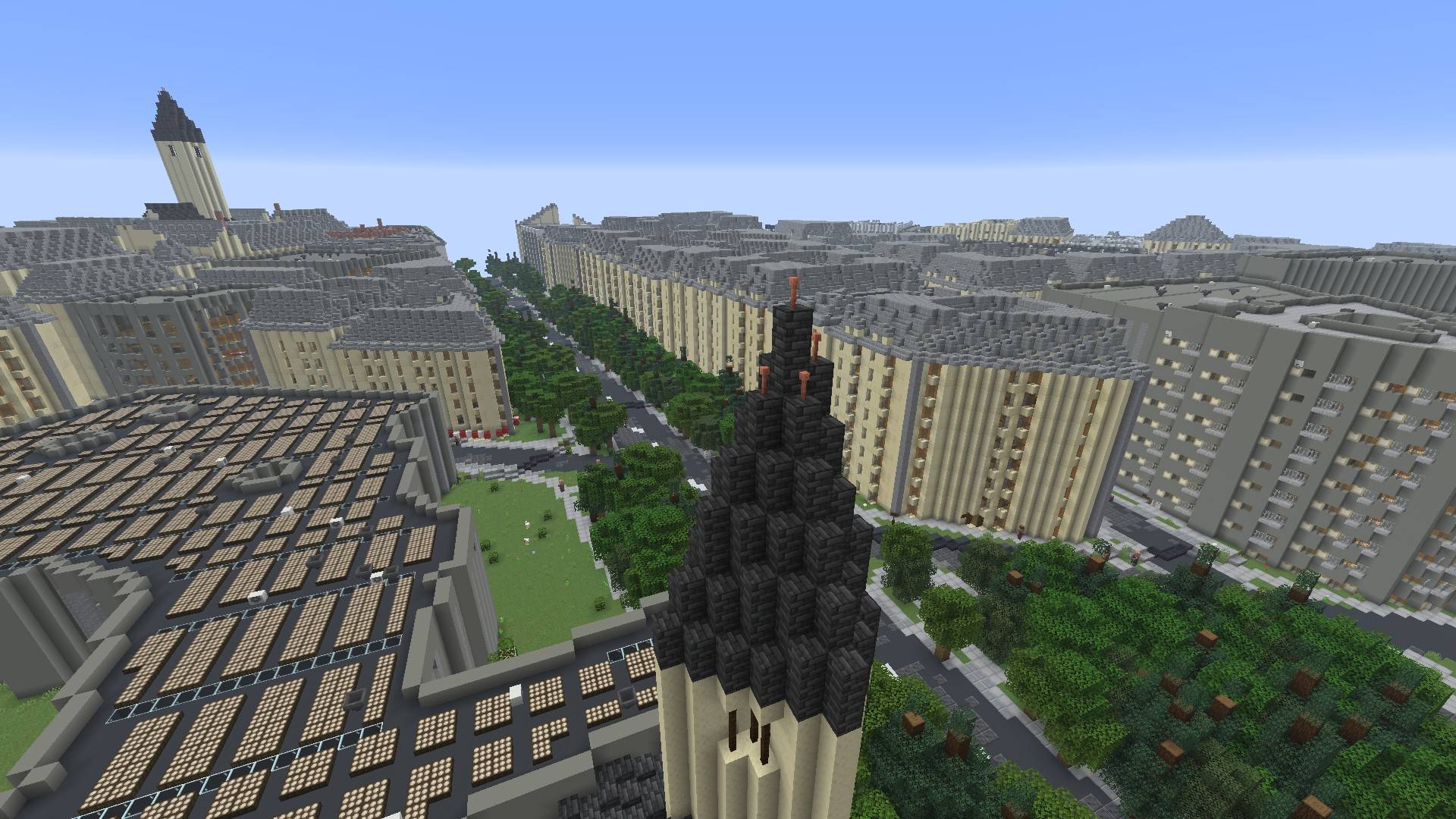
- Regional architecture: Haussmann buildings in Paris, Alsatian half-timbering, northern brick, Breton stone, Basque houses, ochre southern façades… and façades that change with the year of construction.
- Lively streets: shopfronts with the names of real shops, blade signs, pharmacy crosses, furnished interiors, staircases, courtyards and gardens inside city blocks.
- Terrain and water: real elevation, rivers, lakes, coastlines, bridges and quays.
- Countryside: this week's crops from Sentinel-2 satellite imagery, hedgerows, orchards, farms and silos.
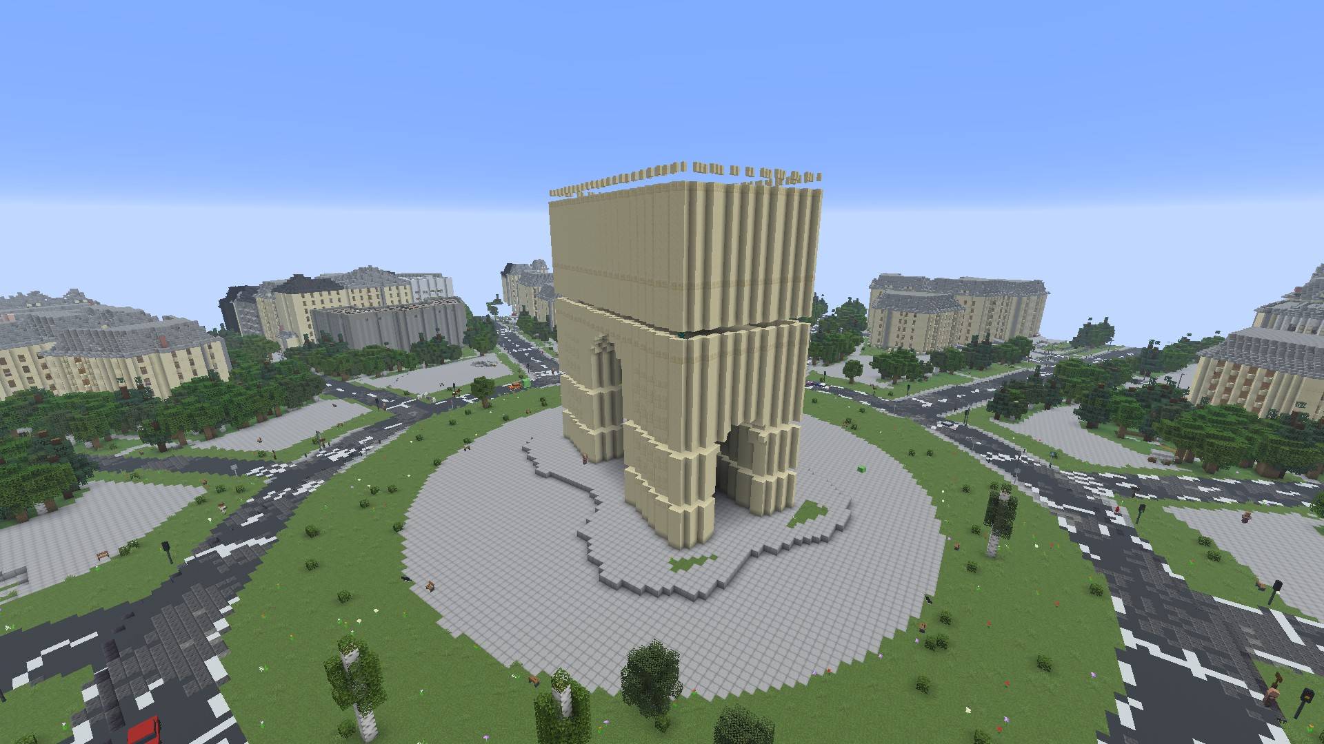
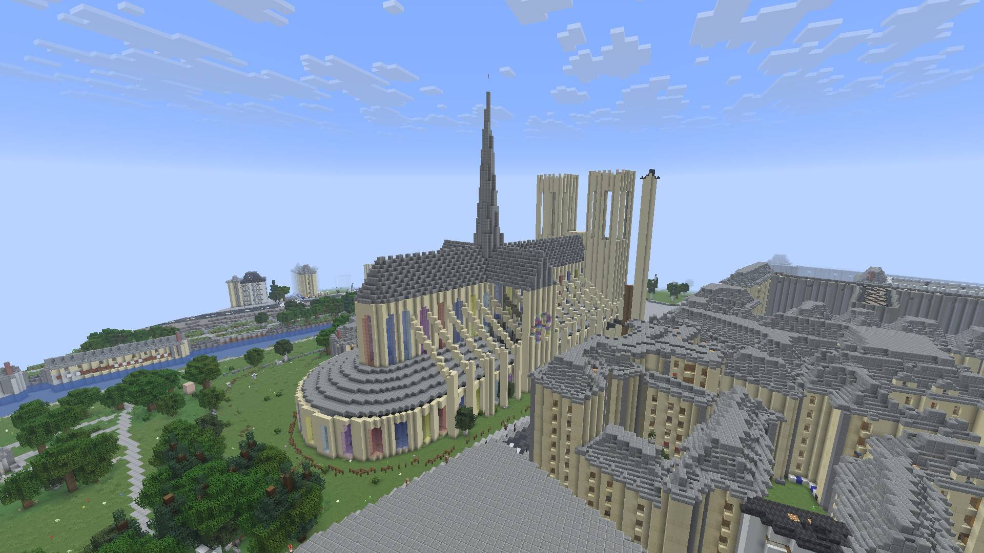
- 25+ hand-modelled landmarks: Eiffel Tower, Arc de Triomphe, Notre-Dame, Sacré-Cœur, the Louvre, Strasbourg, Reims and Chartres cathedrals, Chambord, Millau Viaduct, Pont du Gard… and elsewhere Big Ben, the Statue of Liberty, the Colosseum, Sagrada Família, the pyramids of Giza. - The metro: tunnels, underground stations and entrances.
Petite France, Strasbourg
A living world
- Real trains (SNCF), buses and trams, planes (OpenSky) at their real positions.
- Car traffic calibrated on real road counts, with traffic lights, stop and give-way signs.
- Pedestrians on the sidewalks, waiting at the lights to cross.
- French road signs modelled block by block, street lamps, benches, bins, bollards and bike racks.
- Optional: real weather and real sun (game time follows local time).
Paris at night
An interface built for exploring
- New, clean and fast menus, in English or French (picked at first launch).
- OpenStreetMap minimap with the live street and town name.
- Travel map (V key): search for a place and go there. - Notebook of discovered places.
- Commands: /terre tp, /terre aller, /terre ici, /transports.
Requirements
- Minecraft 26.3 with NeoForge 26.3.0.103 or newer, Java 25.
- An internet connection: data is downloaded as you go.
- Detail is highest in France (IGN data). Elsewhere, the world is built from OpenStreetMap. ## Multiplayer The mod works on servers: each group of players gets its own traffic and pedestrians.
Data credits
© OpenStreetMap contributors (ODbL) · IGN: BD TOPO, aerial imagery and elevation (Etalab Open Licence) · Copernicus Sentinel-2 · Open-Meteo · OpenSky Network · SNCF · transport.data.gouv.fr · Bison Futé · City of Paris open data · Nominatim. Inter typeface (SIL Open Font License).
Version 0.1.0 — first public release. Feedback is welcome in the comments. Developed with the help of Claude (Anthropic), an AI coding assistant.
TrueEarth Team
