ThreeOSeven Studios - Cartographer MiniMap
- By
A feature-rich minimap with explored world maps, cave layers, Smart Navigator routes, entity radar, and persistent waypoints.
Screenshot (142).png
Screenshot (143).png
Screenshot (144).png
Screenshot (145).png
Screenshot (146).png
Description
307 Studios - Cartographer
Explore farther without losing your way. Version 1.0.3 of 307 Studios -
Cartographer combines themed surface and elevation-banded cave maps with Smart
Navigator routes, live guidance, breadcrumbs, expanded radar, and a complete
waypoint/recovery system for Minecraft 26.2.
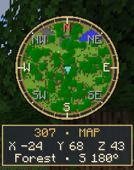
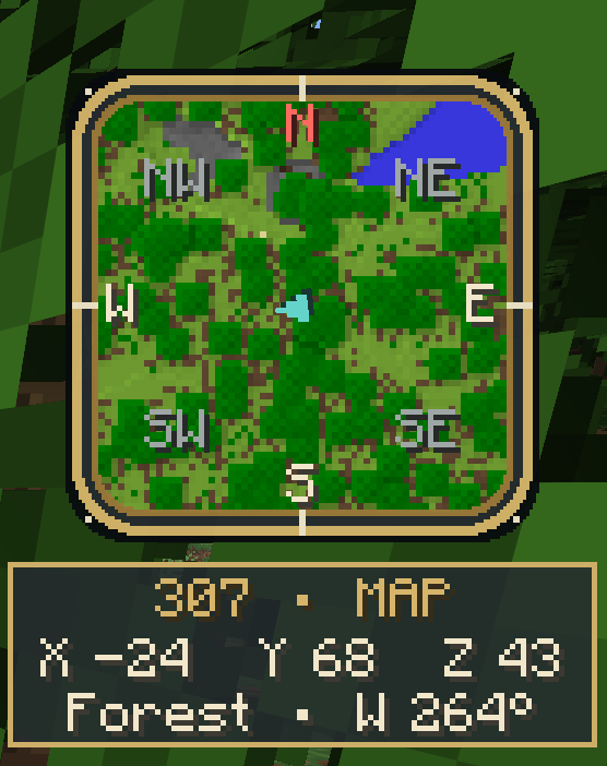
The minimap includes terrain colors, slope shading, heading-up and north-up
modes, multiple zoom levels, Small/Medium/Large saved HUD sizes,
Circle/Rounded Square/Square frames, hold-to-expand viewing, and coordinates,
biome, elevation, eight-point direction/degree, game-time, day-count, FPS, and
light-level details.
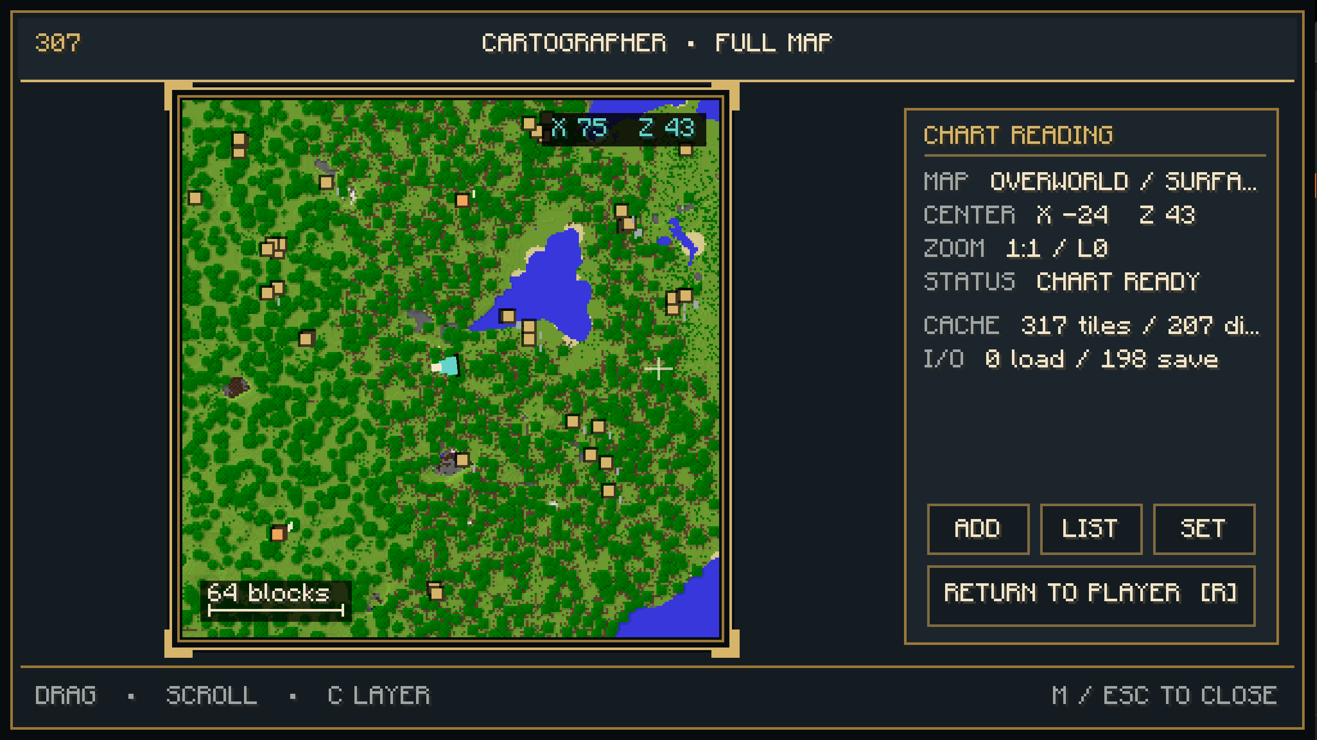
Press M to open the non-pausing fullscreen Expedition Map. Explored terrain is
saved separately for each world and dimension. Drag to pan, use the mouse wheel
to zoom, view world coordinates under the cursor, and press R or Home to return
to the player. M or Esc closes the map. Unknown terrain remains covered by map
fog until the client has legitimately received it.
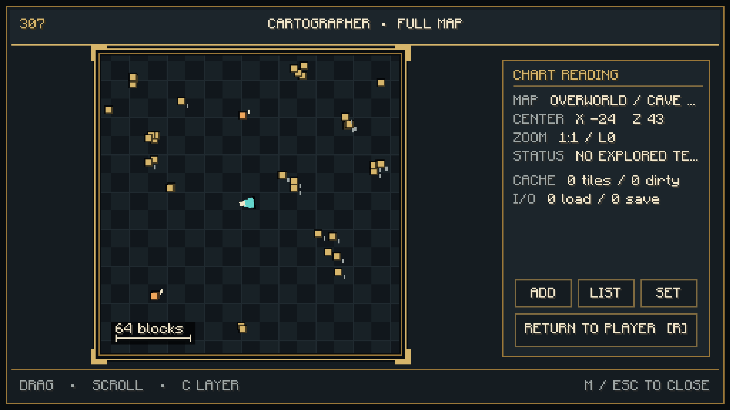
While underground, Cartographer automatically switches to a persistent cave
plane for the player's current 16-block elevation band. Passage floors are
colored and shaded separately from the surface, sealed passages clear on a
later rescan, and the HUD labels the active Y band. Press C on the fullscreen
map to switch between Surface and the current cave band. Automatic Cave Maps
can be disabled in the Minimap settings tab.
Create a waypoint at your position with B, or press B at the fullscreen-map
cursor. Wheel zoom now reaches 8 blocks per pixel using persistent coarse tiles.
You can also right-click the fullscreen map to mark that location.
Waypoints support names, groups, notes, exact coordinates, dimensions, colors,
icons, visibility, and local/global scope. Their markers appear on the minimap
and fullscreen map.
Press U for the searchable waypoint and death-point manager. Filter the list by
current dimension, all dimensions, death history, or hidden markers; sort it by
distance, name, or recent activity; then edit, show/hide, target, or delete an
entry. Cartographer automatically records death points and keeps the 10 most
recent by default. A death point can also be converted into a normal waypoint.
Choosing Target adds horizontal-distance and vertical-difference labels plus a
trail that records meaningful movement on both maps while that target remains
active. Live guidance also reports compass bearing, whether to continue, turn
left, turn right, or turn around, and when the player has arrived. A target in
another dimension names that dimension instead of showing a misleading route.
The trail resets with the target and is bounded to 512 session-only points.
Smart Navigator plots a separate cyan-and-ivory route over explored surface or
cave heights, avoids unknown terrain and steep edges, supports partial distant
routes, and recalculates as the player or explored map changes.
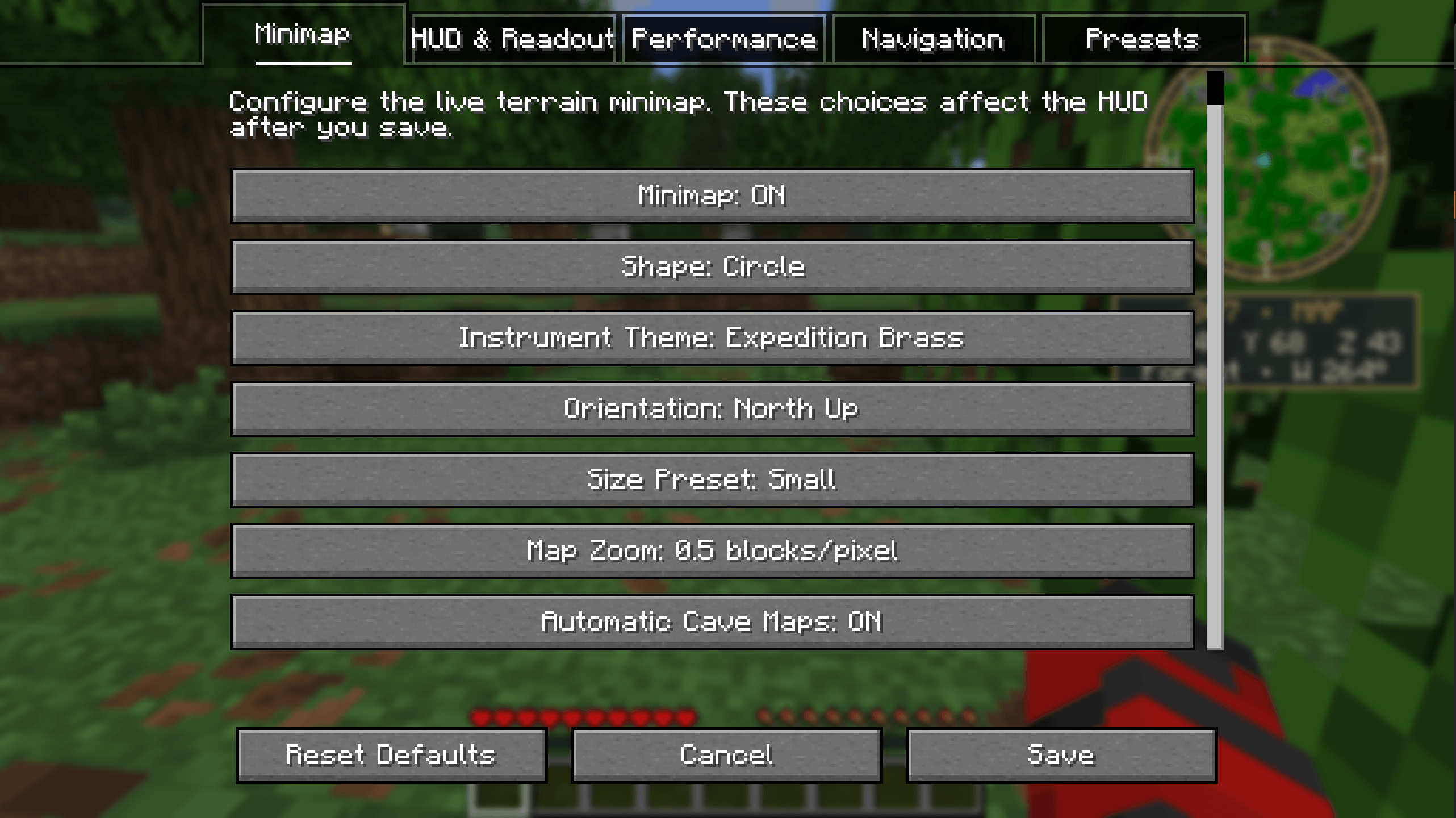
Press apostrophe (`'`) for Cartographer settings. The Minimap, HUD & Readout,
Performance, Navigation, and Presets tabs expose map shape, four instrument
themes, orientation, size, zoom, HUD layout, readouts, charting workload, Smart
Routes, breadcrumbs, radar labels, and four carefully scoped setups. Preset
changes are staged until Save; Cancel leaves saved configuration untouched.
The entity radar distinguishes passive, neutral, hostile, boss, owned-companion,
player, and dropped-item contacts already known to and rendered by the client,
bounded to 256 blocks and 256 contacts. Nearby contacts and important contacts
can be labeled on the fullscreen map. Player and dropped-item contacts are
separate opt-ins and disabled by default. Cartographer never requests hidden entities.
#### Controls
Every keyboard control can be changed under **Options → Controls → Key Binds →
307 Studios - Cartographer**.
**Minimap and general controls**
- **M** — Open or close the fullscreen map.
- **H** — Show or hide the HUD minimap.
- **Apostrophe (`'`)** — Open Cartographer Settings.
- **B** — Open the waypoint editor at your current position.
- **U** — Open the Waypoint Manager.
- **Hold Z** — Temporarily expand the minimap.
- **Equals (`=`)** — Zoom in.
- **Minus (`-`)** — Zoom out.
- **N** — Switch between Heading Up and North Up.
- **Left Bracket (`[`)** — Cycle Circle, Rounded Square, and Square shapes.
- **Right Bracket (`]`)** — Cycle Small, Medium, and Large sizes.
**Fullscreen map controls**
- **Left-click and drag** — Pan across explored terrain.
- **Mouse wheel** — Zoom toward or away from the cursor.
- **Right-click** — Open the waypoint editor at the selected map position.
- **B** — Open the waypoint editor at the map cursor.
- **R** or **Home** — Recenter the map on the player.
- **C** — Switch between the Surface and the player's current cave layer.
- **Equals (`=`)** and **Minus (`-`)** — Zoom at the map cursor.
- **U** — Open the Waypoint Manager from the map.
- **Apostrophe (`'`)** — Open Cartographer Settings from the map.
- **M** or **Esc** — Close the fullscreen map.
- The on-screen **Add**, **List**, **Set**, and **Return to Player** buttons
provide mouse access to the same common actions.
**Waypoint and backup lists**
- **Left-click** an entry to select it.
- **Double-click** a waypoint to edit it.
- Use the **mouse wheel** to scroll long waypoint or backup lists.
- The on-screen buttons handle adding, editing, showing or hiding, targeting,
deleting, transferring, backing up, restoring, saving, and cancelling.
The minimap and fullscreen map share one persistent terrain cache. Bounded
nearest-first observers record surface columns and cave passages only from
fully loaded chunks already present on the client; mapping never requests or
generates unloaded terrain. Unchanged chunk observations are suppressed after successful
cache-worker acknowledgement; saturated or failed work is retained and retried
with its original world and dimension identity.
Waypoint data uses atomic, versioned saves and five rolling backups. If the
current waypoint document is malformed, Cartographer preserves the unreadable
file before opening a clean collection. The manager's Backups screen validates
and previews each snapshot and requires a second confirmation click to restore
one.
The manager's Transfer screen exports portable, human-readable waypoint JSON.
Before import, Cartographer validates every entry and previews additions,
conflicts, errors, death-history pruning, and the final count. Choose whether
matching UUIDs are skipped, replaced, or duplicated; a second confirmation is
required before the collection changes. The complete versioned transfer schema
is included inside every release JAR as `WAYPOINT-TRANSFER-FORMAT.md`.
Version 1.0.3 is the current completed release. It includes smaller HUD size
presets, text-safe information cards, elevation-aware radar, and cave detection
that ignores tree canopies.
Created by Geminiz1978 under 307 Studios.
This independent Minecraft mod is not affiliated with or endorsed by Mojang
Studios or Microsoft.
ThreeOSeven Studios - Cartographer MiniMap Team