🌟 Features
🚗 Smart Road GPS & 3D Navigation
- Advanced Pathfinding: Calculates the fastest, most optimal route strictly along your road network.
- Lane Centering: Dynamically centers the navigation line in the median of any road width (from 3 to 24+ blocks wide).
- Directional Flow Control: Fully supports One-Way and Two-Way streets with intelligent routing logic calculated directly from your current position!
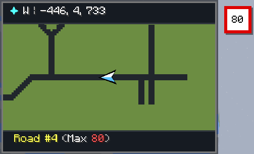
- Speed Limits & Street Names: Dynamically displays real-time street names and authentic speed limit signs on your HUD as you drive or walk.
- Road Visibility Toggle: Choose whether individual road segments are colored and visible or completely hidden from the map and radar while keeping smart GPS navigation 100% active over them!
- No Corner Cutting: Stays 100% inside road intersections without clipping grass or curbs.
- Visual 3D Guidance: Guides you with a smooth, glowing line in the 3D world and on your mini-radar HUD.
🌉 Multi-Layer Bridges & Tunnels System (NEW!)
- 3D Height-Aware Routing: Define any road segment as SURFACE, BRIDGE, or TUNNEL. Overpasses and underpasses never collide or merge erroneously!
- Layer-Ordered Rendering: Tunnels render subterranean with dimmed lighting, surface roads render normally, and elevated bridges render on top with realistic, semi-transparent drop shadows.
- Smart Vertical Snapping: The GPS pathfinder intelligently calculates vertical road clearance so high bridges passing over low roads never cause accidental shortcuts.
🖨️ High-Resolution Map PNG Exporter (NEW!)
- One-Click Ultra-HD Export: Export your entire explored world as a lossless, high-resolution PNG image directly from the map sidebar.
- Saved Location: Exported map images are automatically saved to: 📁 .minecraft/gps_maps/exports/
- Vector Overlay Stitches: Automatically stitches all explored regions with drawn road networks, waypoint badges, and a crisp HUD distance scale legend.
- Instant In-Game Link: Click directly on the chat message to immediately open the exported map in your default photo viewer or folder!
✨ Cyber Glassmorphism & Animation Engine (NEW!)
- Frame-Independent Physics Engine: Ultra-smooth easing animations computed via real-time delta timing — buttery smooth on 60Hz, 120Hz, 144Hz, and 240Hz+ displays!
- Tactile Interactive Buttons: Features continuous hover interpolation, vibrant expanding accent stripes, outer neon glow auras, subtle text/icon nudges, and physical 1px tactile click depression.
- Frosted Glass Pop-In Modals: Dialogs smoothly scale in with an elastic spring bounce, layered soft drop shadows, and high-tech corner brackets across all menus.
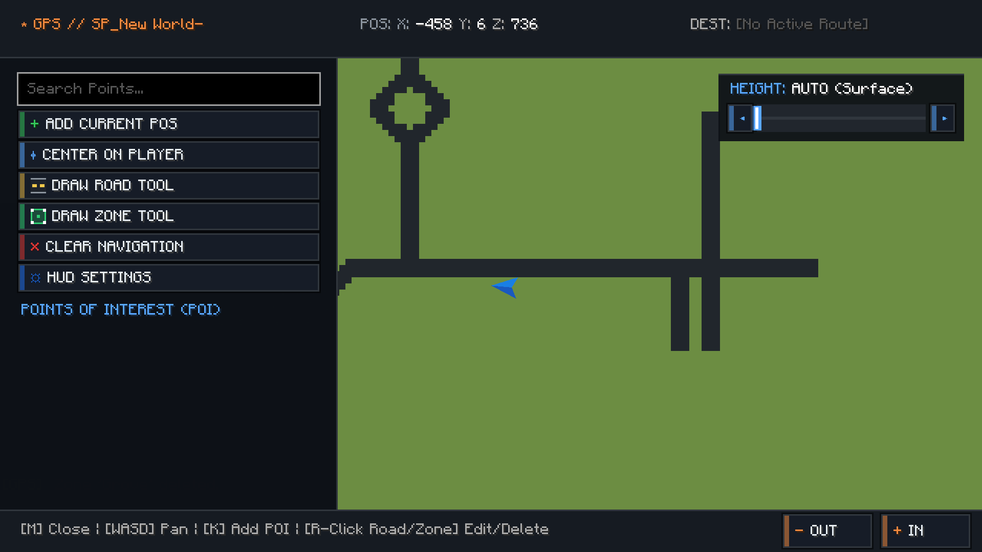
- Dynamic Fullscreen Map Sidebar: Opens with a smooth slide-in deceleration animation, glowing search box halo, and an animated live RTK GPS satellite lock beacon.
🌈 Dynamic RGB & Chroma Rainbow System (IMPROVED!)
- Compact Responsive Layout: Redesigned to fit 100% cleanly on any screen resolution and any Minecraft GUI Scale (Small, Normal, Large, Auto) without clipping off-screen.
- Instant Save Controls: Dedicated glowing SAVE (ENTER) and CANCEL (ESC) buttons, plus full keyboard ENTER / Numpad Enter key support to immediately save colors from anywhere!
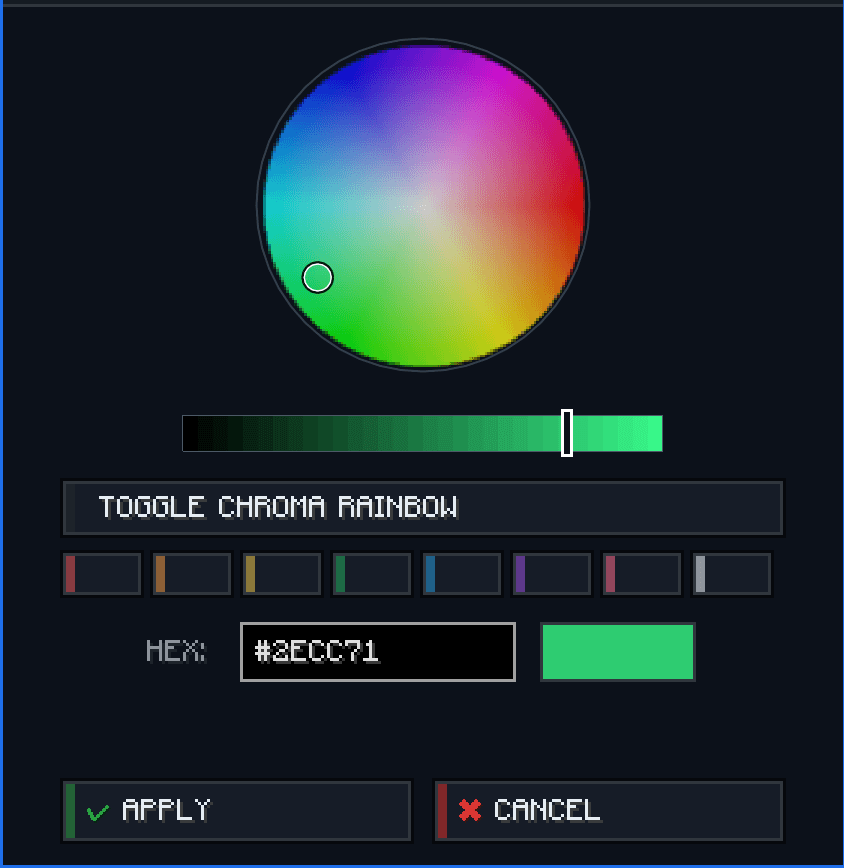
- Pulsing Selection Beacon: Interactive radial color wheel with a pulsing neon beacon handle, brightness slider, hex code input, and a live glowing PREVIEW badge.
- Animated Chroma Waves: Turn on dynamic rainbow mode for flowing Chroma waves on your 3D GPS route line and HUD minimap border!
- Dynamic Biome RGB Accents: Minimap border smoothly adapts its glowing color to match your surrounding biome or dimension (Lush Greens, Ocean Blues, Desert Golds, Nether Crimson, Void Purple)!
🗺️ Territory & District Zones
- Visual Draw Zone Tool: Click and drag directly on the fullscreen satellite map to define and color-code custom districts, territories, and safe zones.
- Real-Time Map & HUD Overlays: Displays crisp borders and translucent shaded areas on both the fullscreen map and HUD radar.
- Dynamic Zone HUD Indicator: Automatically detects and displays the active territory zone name in your HUD footer as you enter (e.g. [Downtown District], [Airport Safe Zone]).
🎨 Beautiful, Accurate Satellite Map Engine
- Dynamic Mod Block Colors: The map engine intelligently inspects 2D texture sprites of ANY unknown or modded block to calculate its exact true average color. No more ugly grey blocks for custom mods!
- Rich Xaero-Style Colors: Features vibrant biomes, natural grass/foliage shading, and realistic water depth gradients.
- Topography Hillshading: Beautiful 3D depth perception based on terrain height.
- Subterranean Cave Mode: Keeps full surface trees and mountains intact; automatically reveals hollow tunnels and underground chambers when descending into caves.
- Zero Lag: Asynchronous background chunk writer with 0% CPU impact. Real-time updates within 3 seconds when placing/breaking blocks.
🎛️ Fully Customizable HUD Radar
- HUD Settings Menu: Easily drag, drop, and resize your minimap anywhere on the screen!
- Custom Borders & Accents: Switch between Dynamic Biome, Chroma Rainbow, Custom RGB, or Classic Dark border styles.
- Radar Visibility Toggles: Toggle roads, waypoints, and territory zones on/off your minimap HUD at any time.
🖼️ Custom PNG Waypoint Icons! Put any .png image in: 📁 .minecraft/gps_maps/custom_images/ When creating a waypoint on the map (M key), select your custom image to display it as an authentic icon badge on the map!
💾 Share Explored Maps, Zones & Road Configs with Friends! Explored map data, zones, and road networks are automatically organized per server in: 📁 .minecraft/gps_maps/servers/<server_ip>/ Just copy the server folder and send it to your friends — they will immediately have your entire explored map, waypoints, custom zones, and drawn road networks!